عضویت
عضویت  ورود اعضا
 راهنمای خرید


Mapping Toolbox 3.20 pages
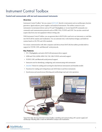
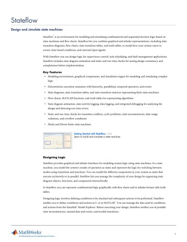
Instrument Control Toolbox table.main {} tr.row {} td.cell {} div.block {} div.paragraph {} .font0 { font:8.00pt "Times New Roman", serif; } .font1 { font:15.00pt "Times New Roman", serif; } .font2 { font:5.00pt "Trebuchet MS", sans-serif; } .font3 { font:7.00pt "Trebuchet MS", sans-serif; } .font4 { font:9.00pt "Trebuchet MS", sans-serif; } .font5 { font:10.00pt "Trebuchet MS", sans-serif; } .font6 { font:19.00pt "Trebuchet MS", sans-serif; } Mapping Toolbox 3.2 Analyze and visualize gographie information Mapping Toolbox provides tools and utilities for analyzing g险ographie data and creating map displays. You can import veetor and raster data from shapefile, GeoTIFF, SDTS DEM, or other file formats, as well as Web-based data from Web Map Service (WMS) servers. The toolbox lets you eustomize the imported data by subsetting, trimming, interseeting, adjusting spatial resolution, and applying other methods. With features for fields such as geodesy, navigation, and digital terrain analysis, the toolbox enables you to develop geospatial analyses and illustrate the results. Geographic data can be combined with base map layers from multiple sources in a single map display. Mapping Toolbox and MATLAB enable you to develop customized solutions to geospatial problems such as predicting weather patterns, modeling the movement of glacial land masses, or finding optimal locations for wind turbines. With function-level access to all key features in the toolbox and the high-level MATLAB language, you can develop innovative algorithms and automate your workflow for repetitive tasks. Key Features ■ Vector and raster data import and export from standard formats and specific data products ■ Data retrieval from Web Map Service (WMS) servers for customized geographic data sets and related metadata ■ 2D and 3D map display, customization, and interaction ■ Digital terrain and elevation model analysis functions, including profile, gradient, line-of-sight, and viewshed calculations ■ Geometric geodesy, including distance and area calculations, 3D coordinate transformations, and more than 65 map projections ■ Utilities for converting units, adjusting spatial resolution, wrapping longitudes, and managing spatially referenced images and raster data Blue Marble image courtesy of NASA-JPL/Caltech. ^MathWorks Accelerating the pace of engineering and science
"